Sailopia.com - Hunting Island, SC. Offshore Buoy Weather Reports for Sailors and Boaters.
Station 41067 - FRP2WAVE
May 9, 2024 10:45 pm EST
Location: 32.276N 80.406W or 5 nautical miles S of search location of 32.36N 80.41W.
Significant Wave Height: 4 ft
Dominant Wave Period: 26 sec
Average Period: 6.0 sec
Mean Wave Direction: ESE (121°)
Water Temperature: 75°F (23.7°C)
Station ACXS1 - BENNETT'S POINT, ACE BASIN RESERVE, SC
May 9, 2024 10:45 pm EST
Location: 32.559N 80.454W or 12 nautical miles N of search location of 32.36N 80.41W.
Wind Direction: WSW (240°)
Wind Speed: 3 knots
Atmospheric Pressure: 29.80 in (1009.0 mb)
Air Temperature: 69°F (20.6°C)
Dew Point: 66°F (18.9°C)
SHIP
May 10, 2024 05:00 UTC
Location: 31.9N 80.3W or 28 nautical miles SSE of search location of 32.36N 80.41W.
Atmospheric Pressure: 29.80 in (1009.0 mb)
Pressure Tendency: +0.08 in (+2.6 mb)
Air Temperature: 73°F (22.9°C)
Dew Point: 73°F (22.6°C)
Station FPKG1 - 8670870 - FORT PULASKI, GA
May 9, 2024 11:30 pm EST
Location: 32.035N 80.903W or 32 nautical miles SW of search location of 32.36N 80.41W.
Wind Direction: W (280°)
Wind Speed: 8 knots
Wind Gust: 12 knots
Atmospheric Pressure: 29.85 in (1010.8 mb)
Air Temperature: 71°F (21.5°C)
Water Temperature: 78°F (25.3°C)
Station CHTS1 - 8665530 - CHARLESTON, COOPER RIVER ENTRANCE, SC
May 9, 2024 11:30 pm EST
Location: 32.781N 79.924W or 35 nautical miles NE of search location of 32.36N 80.41W.
Wind Direction: W (270°)
Wind Speed: 9 knots
Wind Gust: 15 knots
Atmospheric Pressure: 29.80 in (1009.3 mb)
Air Temperature: 69°F (20.3°C)
Water Temperature: 77°F (24.9°C)
SHIP
May 10, 2024 04:00 UTC
Location: 31.8N 80.2W or 35 nautical miles SSE of search location of 32.36N 80.41W.
Atmospheric Pressure: 29.77 in (1008.1 mb)
Pressure Tendency: +0.09 in (+3.2 mb)
Air Temperature: 74°F (23.4°C)
Dew Point: 73°F (22.9°C)
SHIP
May 10, 2024 05:00 UTC
Location: 32.8N 79.9W or 37 nautical miles NE of search location of 32.36N 80.41W.
Atmospheric Pressure: 29.81 in (1009.5 mb)
Pressure Tendency: +0.04 in (+1.2 mb)
Air Temperature: 67°F (19.4°C)
Dew Point: 65°F (18.1°C)
SHIP
May 10, 2024 04:00 UTC
Location: 32.8N 79.9W or 37 nautical miles NE of search location of 32.36N 80.41W.
Atmospheric Pressure: 29.80 in (1009.1 mb)
Pressure Tendency: +0.04 in (+1.4 mb)
Air Temperature: 68°F (19.9°C)
Dew Point: 66°F (18.7°C)
Station 41076 - CHR60WAVE
May 9, 2024 11:08 pm EST
Location: 32.536N 79.659W or 39 nautical miles ENE of search location of 32.36N 80.41W.
Significant Wave Height: 5 ft
Dominant Wave Period: 26 sec
Average Period: 7.0 sec
Mean Wave Direction: SE (133°)
SHIP
May 10, 2024 05:00 UTC
Location: 31.7N 80.6W or 41 nautical miles SSW of search location of 32.36N 80.41W.
Wind Direction: SW (230°)
Wind Speed: 22 knots
Atmospheric Pressure: 29.88 in (1011.9 mb)
Air Temperature: 76°F (24.2°C)
Dew Point: 70°F (21.1°C)
Water Temperature: 74°F (23.5°C)
SHIP
May 10, 2024 04:00 UTC
Location: 31.7N 80.6W or 41 nautical miles SSW of search location of 32.36N 80.41W.
Wind Direction: SW (220°)
Wind Speed: 15 knots
Atmospheric Pressure: 29.84 in (1010.6 mb)
Air Temperature: 76°F (24.2°C)
Dew Point: 71°F (21.5°C)
Water Temperature: 74°F (23.4°C)
SHIP
May 10, 2024 04:00 UTC
Location: 31.8N 79.9W or 42 nautical miles SE of search location of 32.36N 80.41W.
Wind Direction: SW (230°)
Wind Speed: 23 knots
Atmospheric Pressure: 29.77 in (1008.1 mb)
Pressure Tendency: +0.00 in (+0.0 mb)
Air Temperature: 72°F (22.0°C)
Dew Point: 69°F (20.5°C)
Water Temperature: 79°F (26.0°C)
Station 41029 - CAPERS NEARSHORE, SC (CAP2)
May 9, 2024 10:08 pm EST
Location: 32.803N 79.624W or 48 nautical miles NE of search location of 32.36N 80.41W.
Wind Direction: W (260°)
Wind Speed: 17 knots
Wind Gust: 23 knots
Atmospheric Pressure: 29.76 in (1007.9 mb)
Air Temperature: 73°F (23.0°C)
Dew Point: 69°F (20.8°C)
Station 41065 - CAPERS NEARSHORE WAVES (CAP2WAVE)
May 9, 2024 10:22 pm EST
Location: 32.802N 79.619W or 48 nautical miles NE of search location of 32.36N 80.41W.
Significant Wave Height: 4 ft
Dominant Wave Period: 26 sec
Average Period: 5.0 sec
Mean Wave Direction: SSE (158°)
Your search included the Coastal area of Hunting Island, SC.
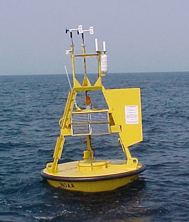
Sailopia.com receives it's data from the NOAA and includes wind, wave, and other marine data collected by the NOAA National Data Buoy Center (NDBC). The data are collected from NDBC moored buoys and from C-MAN (Coastal-Marine Automated Network) stations located on piers, offshore towers, lighthouses, and beaches. Parameters reported by both buoys and C-MAN stations include air temperature and pressure, wind speed and direction, wind gust, and sea surface temperature.
Something of Interest
Sailing is one of the most eco-friendly sports on the planet! with more than 5000 year old technology the sport of sailing is becoming ever more popular in the technological based world. There is nothing greater than to spend a relaxing day on the water!